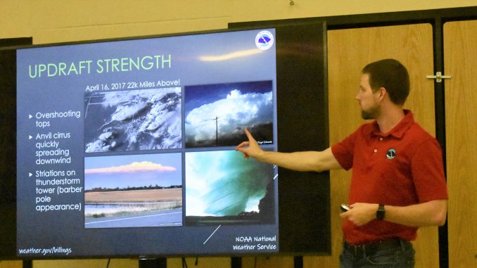
Cory Mottice Warning Coordinator Meteorologist from the Billings, Montana National Weather Service office, presented a training program for community members interested in being storm spotters on Wednesday, May 18, at the Clearmont School. Around 10 people attended the class.
Mottice explained the difference between a storm watch and a storm warning. A watch means that conditions are favorable for extreme weather in or near the watch area and it is issued for tornadoes, thunderstorms and flash floods. A warning means that a severe weather event is imminent or occurring in the area. Also issued for tornadoes, thunderstorms and floods, it focuses on individual storms or cells that meet severe weather criteria.
He explained the limitations of radar,
He said there is a gap around the Clearmont area and they need spotters to keep them informed on the storm systems as they often miss severe weather events in this area.
Spotters are necessary after a storm as well, as the weather service wants information on hail damage, wind damage, and the amount of rain the storm generated.
Wind speeds and tornadoes are only measured by what damage they do to trees and structures. Winds of 120 miles per hour can snap a power pole, and even winds around 100 miles per hour can uproot trees, and even snap them.


Mottice said that lightning is a component of thunderstorms, it is very unpredictable, and can be deadly. It can strike up to 10 or even 40 miles away. Even if you can’t see the storm, if you can hear thunder there is a chance of a lightning strike.
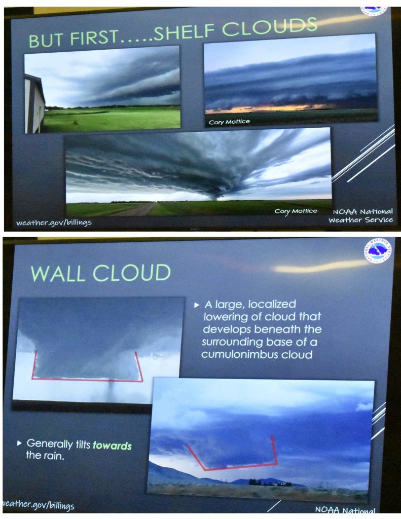
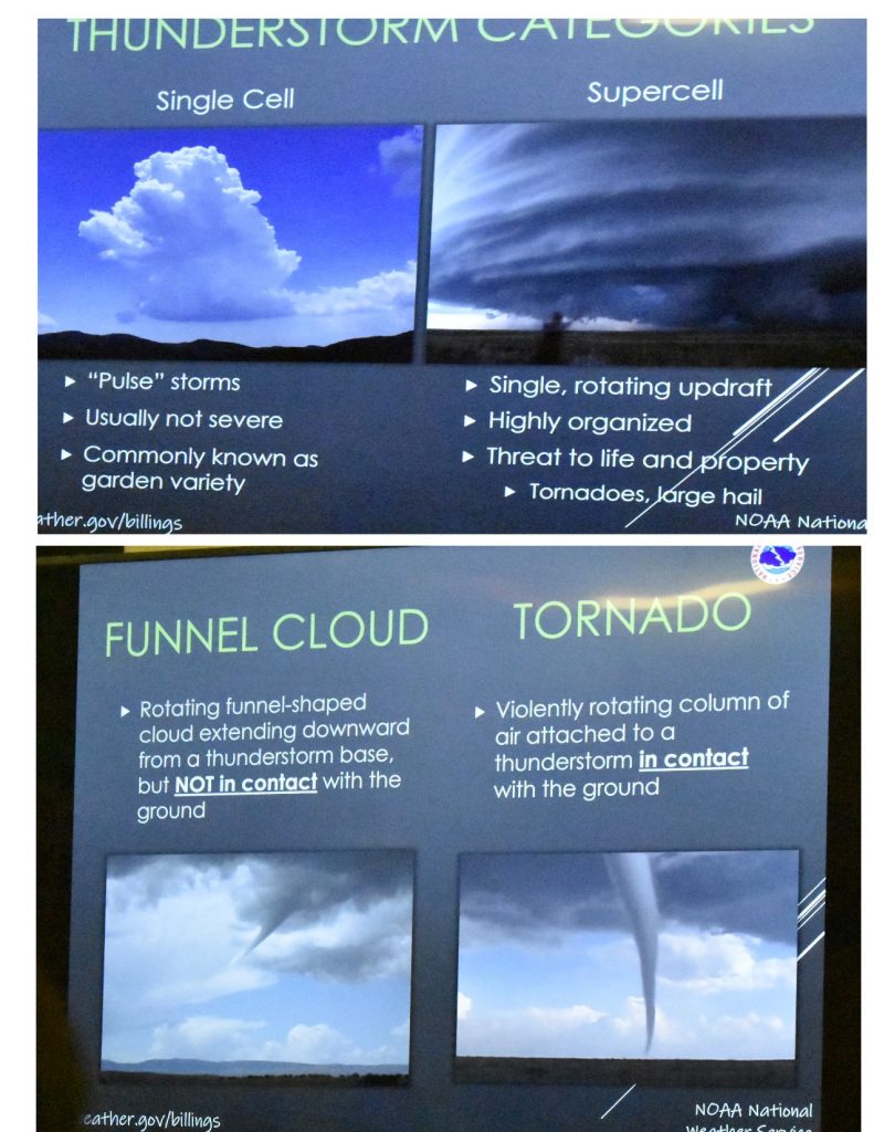
Mottice gave a slide show to illustrate the types of clouds that spotters should be aware of, and what they might produce in the way of bad weather. Shelf clouds can produce storms, usually wind first with rain following but wall clouds are more associated with tornados and severe weather.

He said that tornadoes, like lightning, are unpredictable and that meteorologists still have a lot to learn about them. He talked about safety measures one can take in case of a tornado.
He said if you are in a car, it is best to get out of the car and lay flat in a low spot or a ditch. Don’t stay in the car.

Hail often accompanies thunderstorms, and he displayed a slide of how to measure and report the size of the hail. “Marbles come in all sizes,” he said. “So to say, ‘marble size hail’ isn’t that helpful.” He said that the spotter can either measure the hail stone, or take a photo of it beside something like a coin or a ping pong ball or anything to give a perspective.


He mentioned flash floods, and how little water it actually takes to be dangerous. Six inches of fast moving water can wash a man off his feet, and it only takes 12” to move a vehicle.
He added that when a spotter sees what looks to be a storm cell that may produce a tornado, he suggested that the spotter watches it for 30 seconds or so to see if there is rotation, and a still photo often isn’t very helpful.
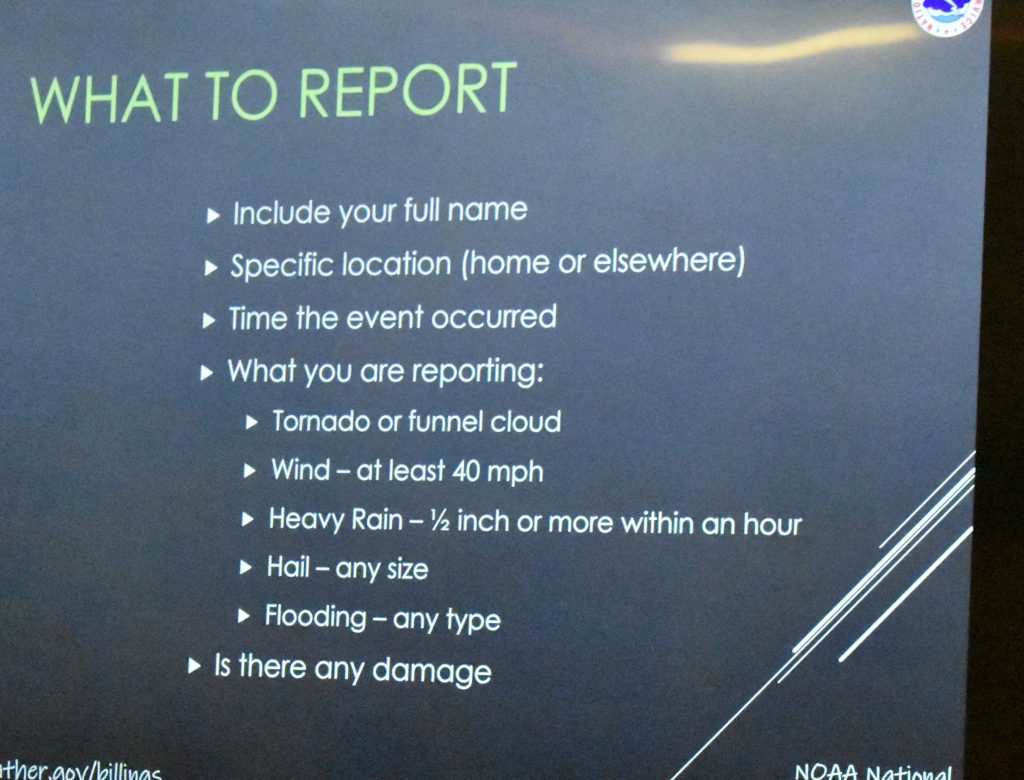
In the case of severe weather, a spotter can call in to the Billings office, and a number was provided for the spotters who took the class. Attendees could also click on a link on the NOAA Billings Weather website to receive a Skywatch Spotter Certificate.
He added that the weather service can also contact the spotter. On the slide he pointed out several green dots and explained how the weather service can contact the spotters that signed up in the class.
The photo below tells how to report a storm to the Weather Service.

Last modified: May 20, 2022

